MAISEMORE GARDENS & FLOOD RISK
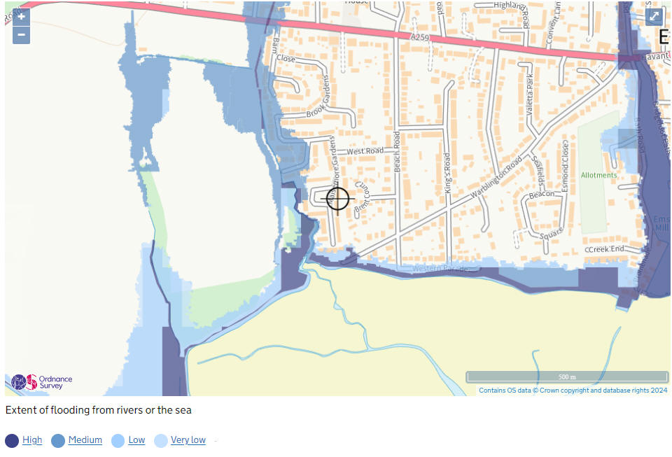
The map
below shows the natural river and coastal floodplains in England
and Wales. A floodplain is the natural 'overspill' area when a
river rises above its banks or when high tides or stormy seas
cause flooding of low-lying coastal areas. River floodplains are
coloured blue. Coastal floodplains are coloured green. Some
areas are at risk of flooding from rivers and the sea. In this
case the colour of the flooding with the greatest extent will be
shown.
They use the best
information available based on computer models, survey data and
historical records and will be updated as new information
becomes available.
For flooding from rivers the
maps indicate the extent of flooding for a one in one hundred
(or a one per cent) chance of flooding each year
For flooding from the sea
and tidal estuaries, the maps show a one in two hundred (or 0.5
per cent) chance of flooding each year
It is important to remember
that the risk of a flood occurring is there at all times - this
year, next year and future years
Being in a floodplain doesn't mean your home or business will definitely be flooded - many other factors come into the equation. The maps are a guide and should prompt people who live near a river or the sea to be aware and find out more."
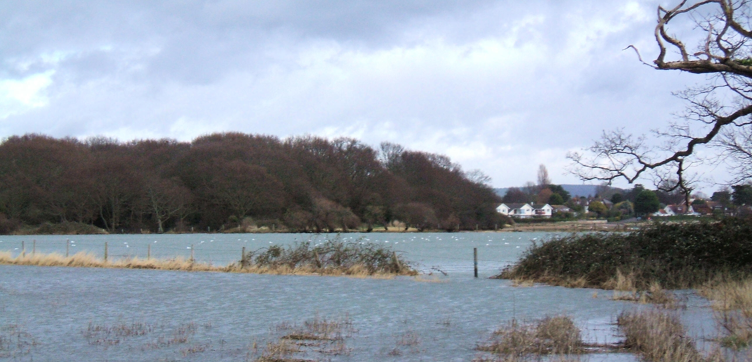 The
view from a flooded field west of Nore Barn Woods, 10th March
2008, the fence is the line byound which is the sea at high
water.
The
view from a flooded field west of Nore Barn Woods, 10th March
2008, the fence is the line byound which is the sea at high
water.
The houses in the background are at the southern end of
Maisemore Gardens
|
Copyright © 2026 Maisemore Gardens Ltd All Rights Reserved.
Website Design: Emsworth
Online |